
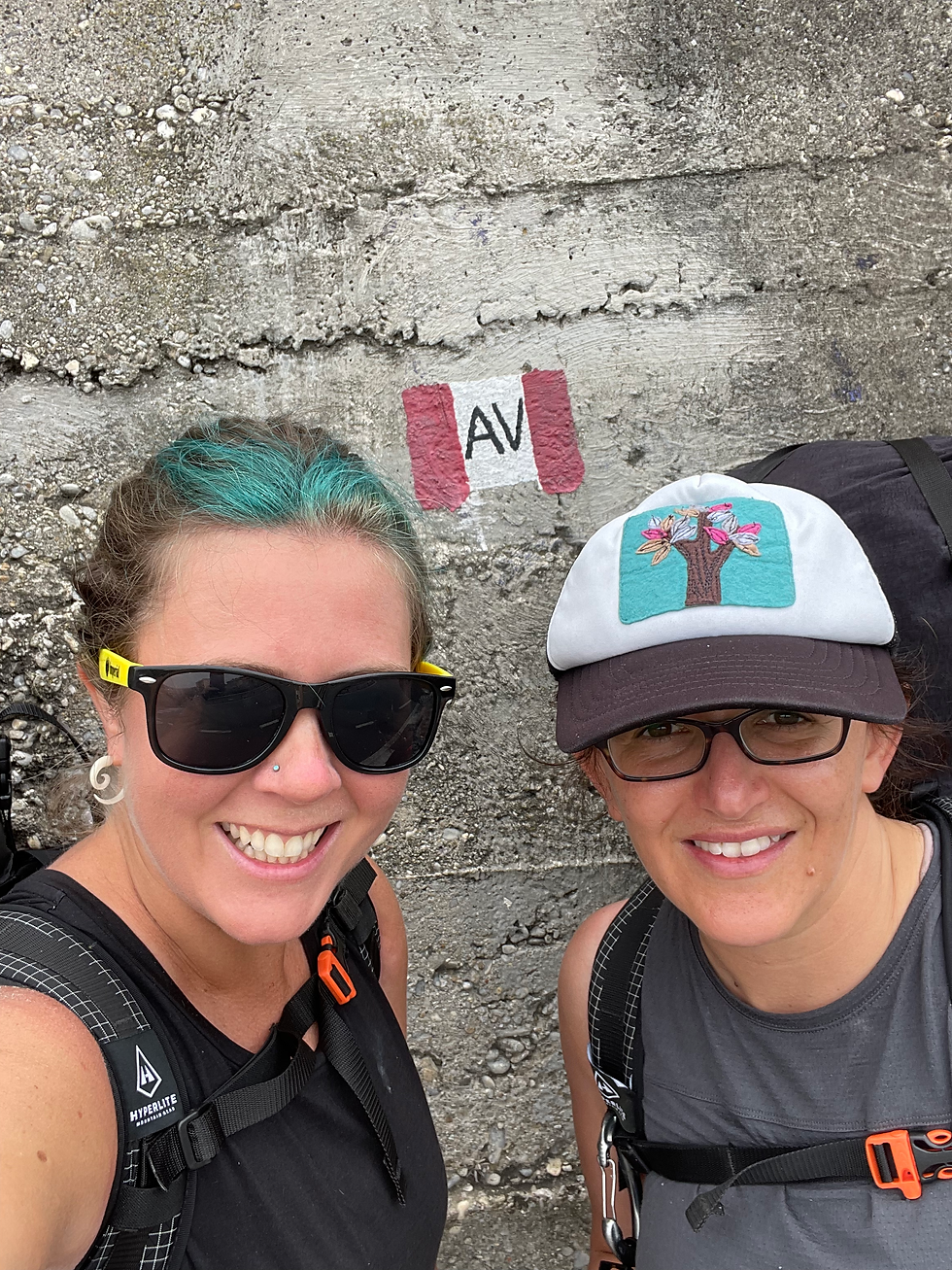
The beginning of the Alta Via Monte Liguri (AVML) and the Southern Terminus of the GTA at the Mediterranean Sea.
Constanza and I start the trail.
We have breakfast on the patio of the Il Forte B&B in Ventimiglia and pack up the last of our belongings. The packs feel heavy, very heavy. In theory we will be able to get food at some of the rifugios (mountain huts), but it is early June, and most of these in the high mountains may still be closed. We don’t know of anyone who has hiked the GTA this early, this direction.
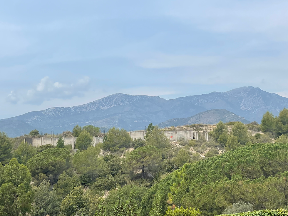
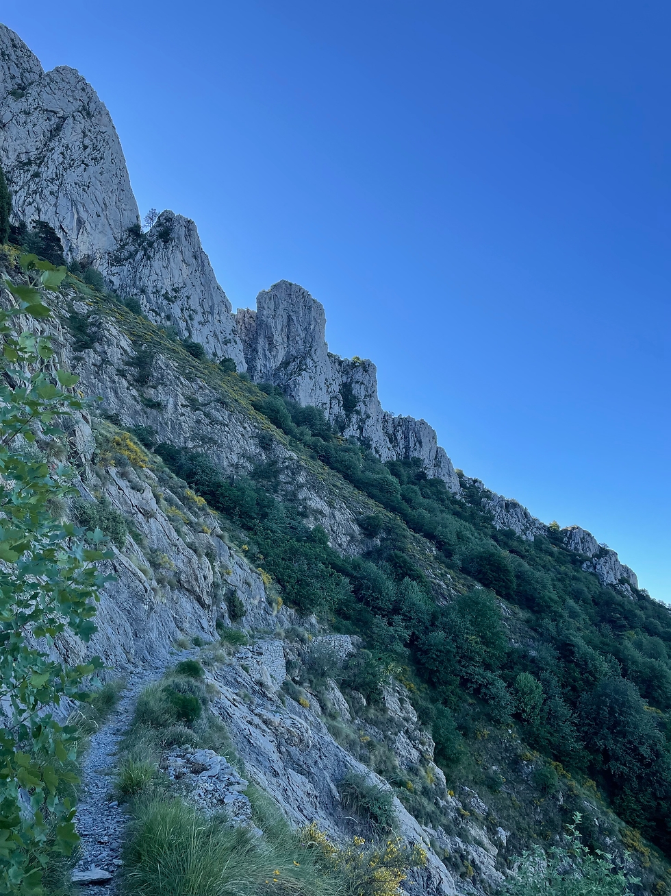
Climbing above Ventimiglia.
We wind our way slowly through the old part of Ventimiglia with its cobblestone streets and ancient city walls, dating to the 14th century. The hubbub of the city increases as we make our way downtown, weaving our way through crowds of Italians going about their Tuesday morning. We cross the train tracks and start to walk up a narrow city street at the edge of town. We come upon a big interpretive sign for the AVML-The Alta Via Monti Liguria, an 80 kilometer route that connects the coastal cities and connects the GTA to the sea.
It becomes hotter, and I slowly sweat my way up the steep switchbacks, out of town. The city sounds fade away, and now I can only hear the ocean, far away at my feet, and we can see the shallow waters near the beach drop off into the sea. We have gained 700 feet. We have 199,300 to go.
We follow paved roads, then dirt roads through a bedroom community. There are lots and lots of AVML markings, which makes it easy to follow. In the afternoon, we come upon the first place marked in the Rother guidebook where we can get water. It is Rifugio Alta Via, but what we see is a house set off the road with a large, imposing locked gate.
Constanza and I look at each other.
“Maybe we should call them?”
Constanza walks along the gate and sees a man playing with a little girl. She waves.
“…..Scuzi?”
She asks if we can get water in Italian. The man looks hesitatingly back to a woman coming out of the house.
“Si. I’ll open the gate.”
We walk into the property and the woman gestures for us to give her our bottles, which she fills with a hose outside.
“That’s four bottles, so that’ll be four euros.”
Constanza and my eyebrows go up, but we give her the money.
“Is there water ahead, do you know?”
“No. No water till Rifugio Gola di Gouta.”
We leave the property. I have never in my life been charged to fill water bottles out of a hose, but I am new to this country and this trail, and there is a lot we don’t know. We make our way down the dirt road.
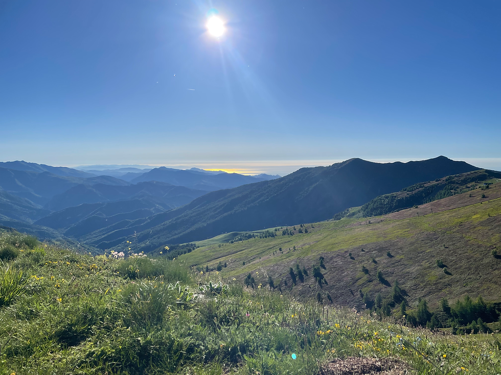
Constanza with views back to the Med.
We come to the Colle Dei Saviglioni, which is a pleasant park area with a beautiful view. There is a huge, newly painted sign for “Saviglioni Spring” with the beginning of a manicured trail. We follow the trail, and a few minutes later we see a large cement tank full of clear water. We are relieved. The owner of Rifugio Alta Via is either financially inclined, or assumes we don’t have water filters (more likely). We joke about how she is going to show up in a few minutes and charge for using this (obviously public) spring. We make our way back up to the Colle and camp here for the night. We hiked 11.1 miles today.

Thankful for water on the route.
Wild boars visit us in the night, according to Constanza. She could hear them snorting a d grunting around our tents. I missed the commotion. We pack up our camp and start hiking as the sun starts to heat up. We come upon a herd of cows, and a farmer shoos the cows off the road so we can pass. “Grazie!” We smile. We come upon Fonte Susena, which has been rigged up with a pipe to water the cattle. We climb up to the pump house and I laugh when I open the door-it’s just a hose under the water level, siphoning water down the hill to the cattle troughs. Basic plumbing.

Fonte Susena’s siphon “system” to the cattle troughs below.
The farmer comes up that we saw before, friendly, and turns on the tap so we can easily fill our bottles. No charges here.
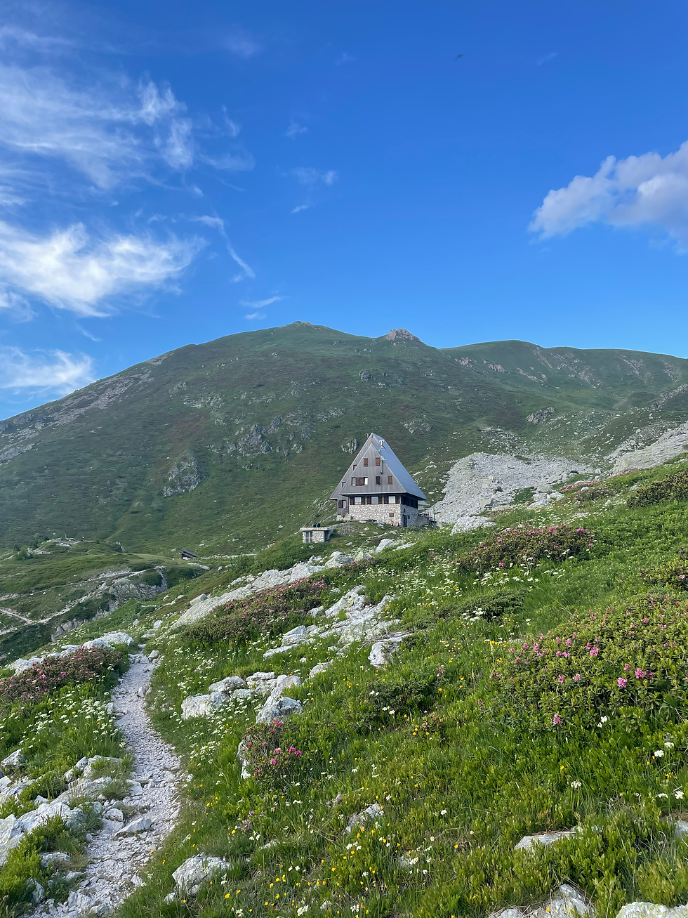
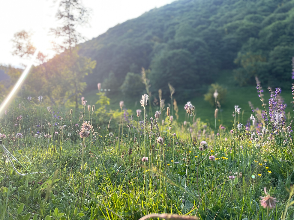
We make our way down the dirt road, and in the afternoon we come upon Rifugio Gola di Gouta-totally closed, no one in site. Two goats bleat at us from an enclosure across the road. Constanza goes to investigate-and finds a working faucet, which we utilize before continuing on. The goats are grateful for the attention. We take a little break in green meadow full of wildflowers and bumble bees. “Cuckoo! Cuckoo!” We hear in the trees.
“That’s a cuckoo bird! It has to be. It sounds exactly like a cuckoo clock”, I say.
One of the interesting things about hiking in Europe is that I grew up reading about the plants and animals that are native here in European or British children’s literature, like Winnie the Pooh, Grimm’s fairy tales, or C.S. Lewis books. Suddenly, you see something like a stork for the first time, or hear a common European cuckoo for the first time-and you realize you had only ever heard or read about it.
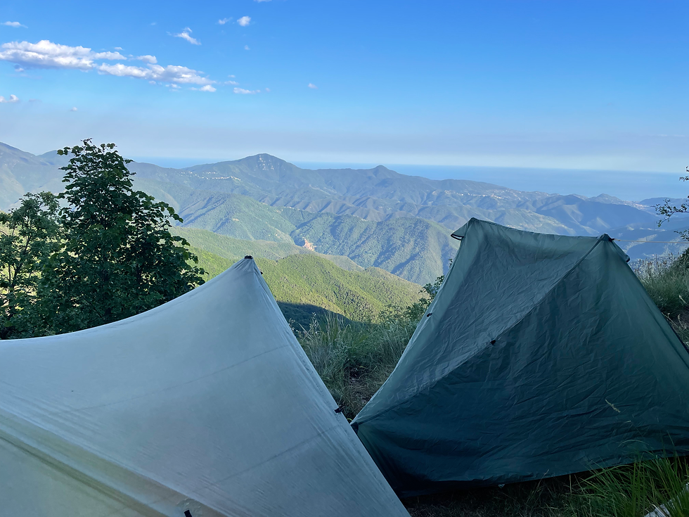
We start to climb again, now on beautiful trail towards Cime de Loganbom, a beautiful towering rocky massif. We camp at Col du Corveau, listening to the cuckoos chat with each other as the sun sets. We hiked 12.8 miles today.
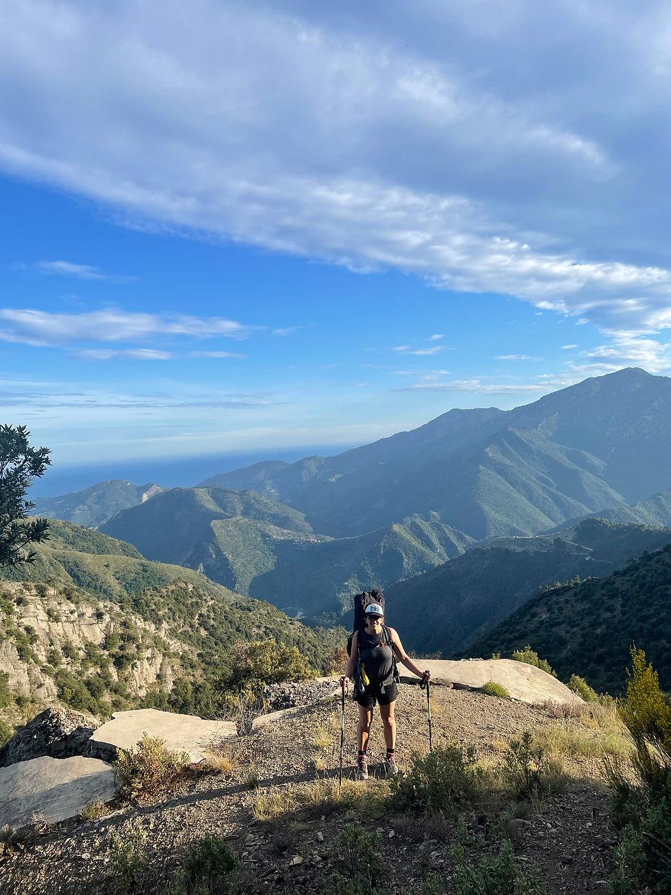
We can still see the Med behind us…
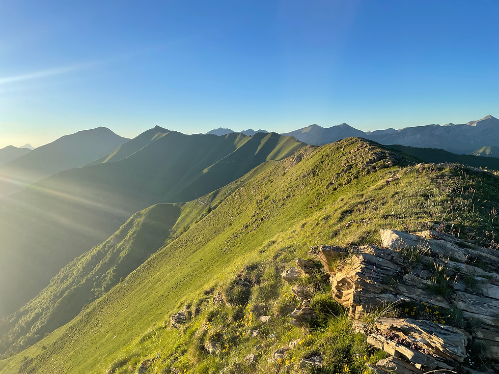
We woke at 7am- a long sleep for both of us. It was windy in the night on the ridge. We begin to hike up the trail neatly cut in the side of the mountain, away from the sea. The air is incredibly clear and we are able to see the island of Corsica off in the distance. Every kind of wild flower is in bloom up here. Herbs grow here, too, naturally-lavender, oregano, rosemary. The air is perfumed with wet earth and flowers and herbs, and the sun is shining, and the grass is so incredibly green. It is early Summer in the Italian Alps.
We meet two men, day hikers, out from Savorno to climb the peak we are traversing around. We tell them in broken Italian what we are doing. Their eyes get very wide. “Siamo pazze!” One says-“you’re nuts!” We cross a pass and descend on the Sentiero degli Alpino, a “via Ferrata” which is an extremely narrow winding trail cut directly into the side of the mountain, absolutely mind blowing views. I cannot believe this is only the third day on this route.

Constanza navigating the Via Ferrata.
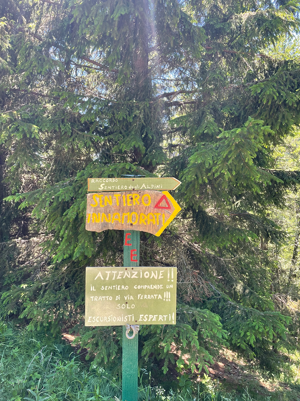
A sign helpfully warning not to attempt the Via Ferrata without expert experience….on the other side of the Via Ferrata
We come upon one beautiful spring, Fonte San Martino, and stupidly gamble that the next spring in a mile will be equally good. It’s not. We descend onto Fonte Italia to discover it is a mess of pipes and irrigation equipment. I do some exploring, climb up and find an unsecured tank full of water-which is initially exciting, until we discover there is a slick of motor oil on its surface, for some reason unknown to us. A bit wilted, we make our way down to the Rifugio Frank Allavena, the first Club Alpino Italiano (CAI) hut we have encountered. The hut is abuzz with activity and the kind proprietor lets us charge our electronics and gives us advice about the coming huts. The two men we met on the ridge stroll in and greet us, showing us their pictures of the summit. They leave soon after. “Italian stallion”, the proprietor says, indicating one of the men to us and rolling his eyes.
We make our way out and start the long uphill climb towards Mont Saccarel. There is no more water to be had until the Rifugio at the very top of the mountain. We debate setting up camp at the mountain’s base, but there are no flat spots-so we wearily start our way up the 1500 foot climb at the end of this long day.
Cresting the ridge of Mount Saccarel.
I feel the weight of my pack, and the layers of salt dried on my face, and I breathe hard, taking a rest every ten steps it seems-and the mountain turns emerald gold in the evening sun, and everything is sideways-slanted-steep sides of mountain-and I feel that I am between dreaming and awake, because these are the places that I dream of.
Little flowers gently close as the day ends, gold and pink and paper white and orange and purple. Constanza encourages me.
“ only two hundred feet, we’re almost there…”
“vertical or horizontal?” I joke.
We clear the crest. It is impossibly beautiful. The ridge runs in a sharp knife along its crest, and down to the right, Rifugio La Terza twinkles in the last of the sunset’s light. The village below lights up, tucked into the pocket of the mountains, and we are standing on the top of the world and the mountains spin around us, infinite to the north-the Mediterranean Sea to the south, going to sleep in a blush of purple. We walked 16.4 miles today, gaining 6000 feet.
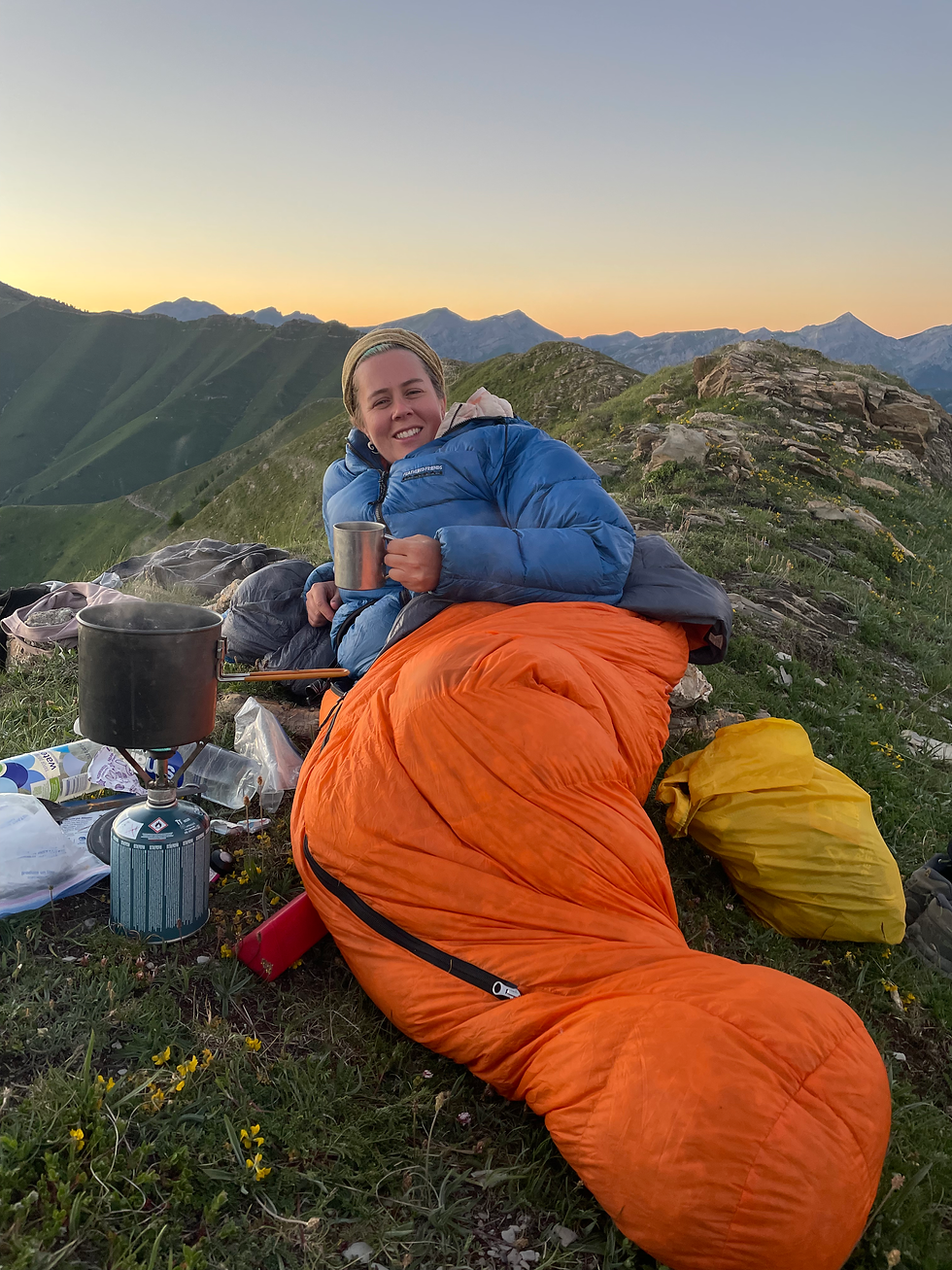
Me in all my “downy” glory at the end of a 6000 foot day.
I wake up with the sun coming up over the Mediterranean Sea at 5:55 am, distant and orange fire. I stick my hand out of my tent fly to take a picture, leaving the zipper undone. The bees wake up with the sun to pollinate all the flowers, and a bee lets himself in through the opening in the zipper, frantically buzzing around the top of my tent with no idea how to get himself out. I finally trap him with my mug and gently direct him out, back to his task at hand. The air is full of bee buzzes and early morning birds. Italy seems more alive than the American west.
I have slept deeply, exhausted from the big day yesterday, only our third day, and we can still see the Med, back the direction we came from, shining in the early morning sun. We pack all of our things into one tent and make our way the 1.3 miles to Il Rifugio La Tirza, for water. Halfway across the ridge an old man stops us to ask if we heard “la chamoche” this morning. He shows us a picture on his phone, a small antelope, typical to the high European mountains.
“Le chamois (French)? Pero….Le chamois….en Italiano?” I stutter.
“La chamoche!” He beams. Now he thinks we are French. But I only know these animals from the French Pyrenees, and I speak almost no French.
We have a simple breakfast at La Tirza and purchase 5 1-liter bottles of water from them-once again, they say they do not have drinking water available from the tap. We need to figure out how to explain that we have filters and don’t need “potable water”, but I just don’t speak enough Italian to communicate this, and it is countercultural- many cyclists and day hikers come through here, but none with water filters. Maybe things will shift when we are in the higher mountains.
We follow winding dirt roads down to the village of Upega. Upega is a thruhiker’s dream. Tiny, compact, with a comfortable campground, an incredible restaurant, a tiny grocery all in one. We charge our electronics and wash our clothes by hand and take showers-cold water, the campground isn’t actually open for the season and the electricity isn’t on yet- and enjoy an absolutely incredible 2 course dinner with a bottle of local wine, for 30 euros each. I cannot believe that more people don’t hike this route. We manage to get the last two dinner reservations available, in this, the only restaurant in town.
The restaurant is filled with only Italians and us-young people our age, out for sport in the mountains, young families, with their dogs. This kind of service is such a boon for these tiny villages, which we are told counts only 11 year-round residents. It’s a win-win situation.
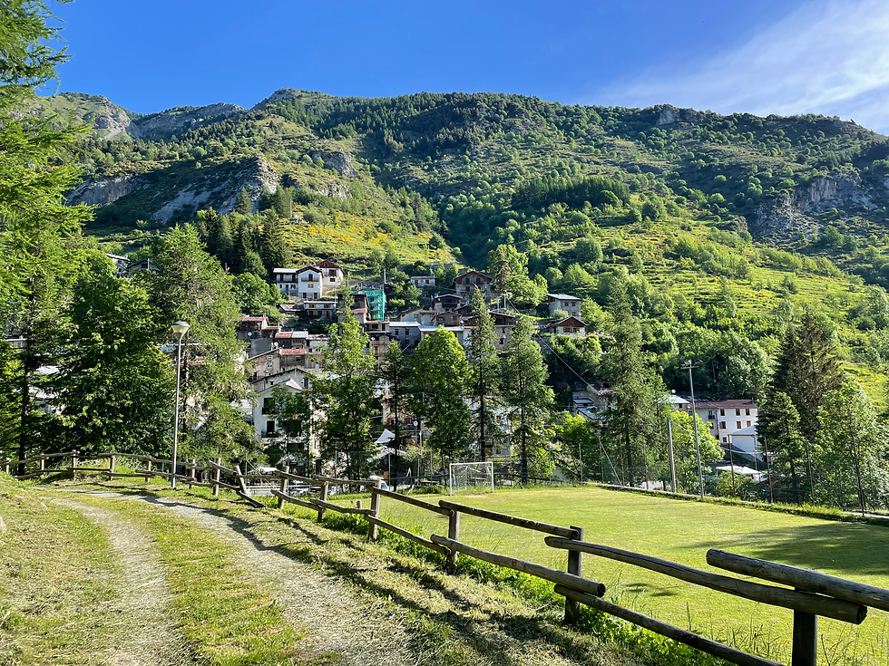
Wonderful, tiny Upega.
I lay down in my tent as it gets dark. We hiked 7.4 miles today on the route, 3 to La Tirza and back.
We wake up in the morning and pack up our tents, getting hiking around 8:30. We walk the road to Carnino, which must be an incredible drive-steep drop offs on one side, towering limestone peaks all around.

The road to Carnino.
Carnino is an ancient stone village with what seems to be a few vacation homes for Modern-day Italians interspersed with empty medieval stone buildings.

Carnino with a trail blaze.
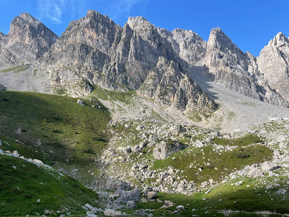
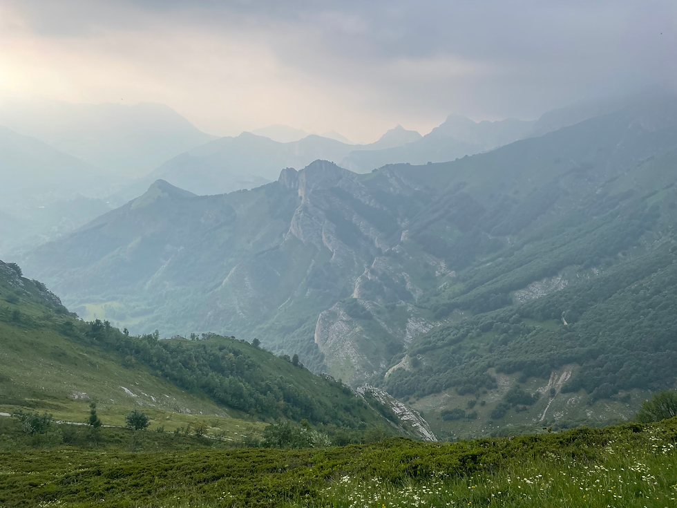
It is sunny and beautiful, starting to get a bit warm. We begin to climb up towards Passo delle Mostrelle, then onwards to Colle del Pas, a high mountain pass. The environment becomes alpine. Green grass, little streams everywhere, wildflowers in a million colors. We cross the Colle and make our way to the other side-and in front of us lies the most incredible mountain valley, the Rifugio Garelli below, tiny, and the Margueis mountain massif to the left, screaming vertical walls of limestone.
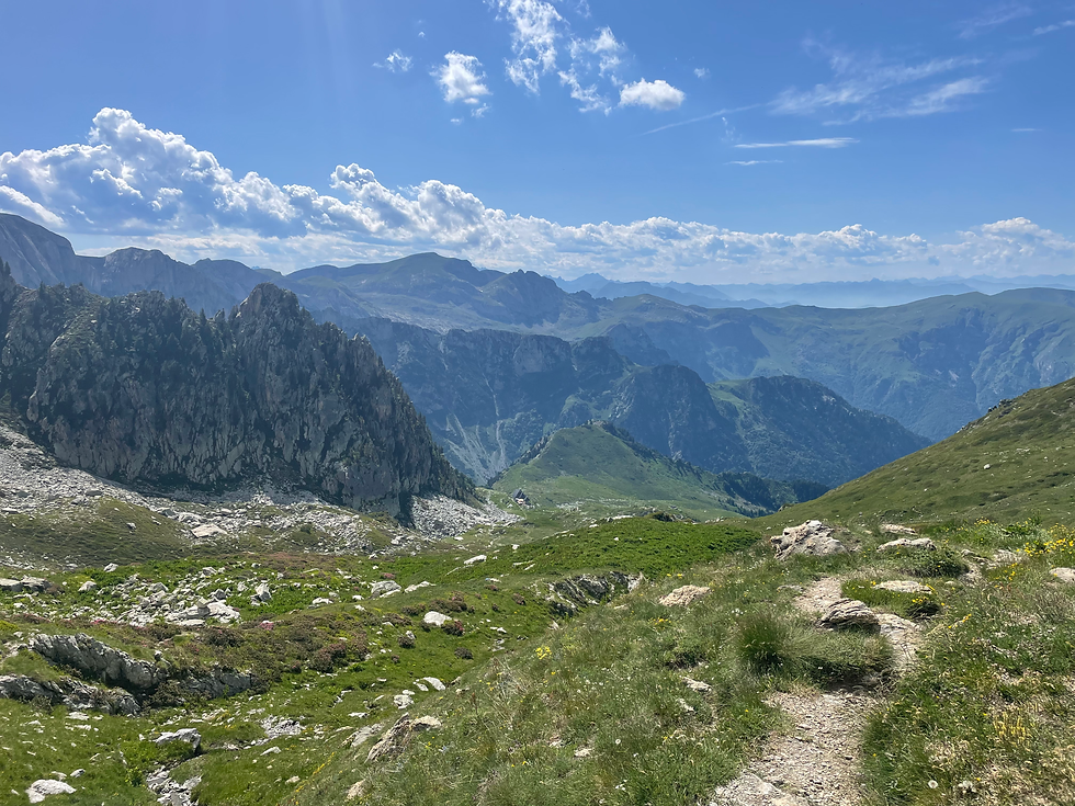
Pictures can’t begin to describe.
The Margueis Massif.
I cannot describe to you the feeling of seeing this place. It is a thing out of my dreams-to float above the world like this, and you are soaring like the birds, looking down on these mountains- with their little chutes of icy snow, a thousand feet up. I am a little brown bird myself, and this is the world in which I live, if only for a while.
We enter Rifugio Garelli and are greeted by three men, two young, and one old-all with kind eyes and quick smiles. They are sitting on the patio.
“If you need a beer or something, we can get it in just a minute-it just that, we just sprayed for the flies, and we can’t go back in right now…”
I smile. The little black flies up here really are persistent, landing in threes and fours on my arms all day.
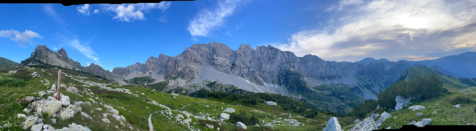
I do order a beer and comment on the awesome outline of the Margueis massif to our left, now in sharp relief in the evening light.
“Yes, actually those are all climbing routes as well,” says the old man.
“Really! Do you climb?” I ask.
“Yes…well. I used to climb. These days, I just climb into my bed,” he says with a humble smile.
“Don’t listen to him. He has climbed every single one of the known routes on that mountain,” one of the young men interjects.
I take my beer out onto the patio. There is very little sound. A few minutes later the old man walks calmly out of the rifugio, unwinds a garden hose, and begins to methodically water the little heads of lettuce in the hoop house. We learn later that this man’s name is Guido Columbo, and he and his family have lovingly maintained this mountain hut since 1980. I am overtaken by the calm and love of this place, with its backdrop of its awesome insurmountable beauty. We hiked 10 miles today.
Beloved Rifugio Garelli.
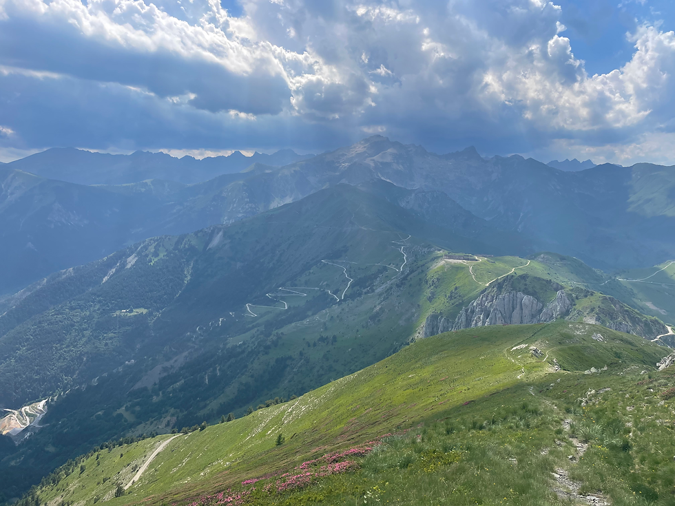
We wake up with the sun and get moving from Garelli around 8. The trail takes a big circle under the Margueis massif and then climbs up in a mind-bending line, snaking around to the north.
It rolls through unbelievable mountains on its way to Tenda pass. Half or so of our walking is on dirt roads today, but still we gain 4000 feet.
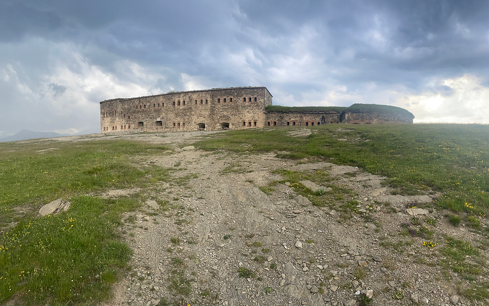
In the afternoon I am coming down alone towards Tenda Pass, and I round a corner and look down-the trail beelines straight down the spine of the mountain I am on, to the Pass, on which sits Forte Centrale, a massive fort built in 1881. The road to Tenda Pass has actually been used since ancient times- the Phoenicians, then the Greeks, then the Romans- for transport between the communities which occupied modern-day France and Italy, and it is the separating line between the Maritime and Ligurian Alps.
As I am descending, I notice a large black thunderhead growing above massive mountain Cima Giosolette opposite me on the other side of the pass. Lightning cracks the sky. I descend to the fort and noticed how creepy and desolate it is-silent, with a storm brewing behind it. It seems poetic to me. Now the fort is nothing but stone blocks, with shoulder-high grass growing inside.
I continue down the trail from the Pass and Constanza catches up with me. We find a little hill near a stream, covered in wildflowers, and make camp for the night. A man comes up the (Roman) road on his bicycle, whistling, and stops to collect some mushrooms. The clouds clear and evening birds sing. The stream runs quietly behind us. We have hiked 14.4 miles today. We gained 4000 feet.
Each day is so incredibly full. Full of light, and colors, and life, and sun, and I can scarcely believe that I am here, living this dream.
My mind has cleared. The light rises in my tent, then slowly, in the right hand corner, orange glows-the sun is rising. The orange glow grows and it warms my face. I am myself again. I am in my body down on the ground. I feel love flowing out of me, and I see the little details-the little ants crawling on my tent, the clover flowers growing under my tent fly, and I hear the songbirds singing because it is morning.
I want to care of women and families. I want to be a part of a long term community. But I always, always come back to here-because this dream-this dream that is actually reality-I can’t be here in the city.
I start to walk up the road and in 10 minutes make a bad decision. The signed GTA route continues on the dirt road to the right, but Rother’s GPS route bends around to the left up a trail at a water trough. I consider this for a moment and then decide to follow the Rother line. The trail abruptly dies in the high grass, except for a few sparsely placed red-blazed boulders, as in winds steeply uphill-then it crosses an electric fence. I spend over an hour wrestling with this situation and then rejoin the official GTA, coming up from the road-probably a 10 minute road walk, max. Oh, well. I sweat my way up the 2300 feet to Passo di Giotto Mieu. The trail enters a cloud, which is mercifully cooler. The other side of this pass is steep, unstable “kitty litter” scree with big drop offs. The trail maintainers have helpfully installed hand cables through here, but it takes me a little while to pick my way down.

I descend all the way down to the village of Palanfré and then immediately begin to ascend again, back into the clouds-I stop for water at a piped spring and hear a loud “barking” sound- a chamoche is standing 50 feet above me, making this sound, and then gallops gracefully off-I wasn’t aware that they make sound. I crest the Colle delle Garbella and begin to descend once again as the sun starts to get low on the sky. The surrounding peaks fade in and out of view in the dusk light, massive and other-worldly, and once again i feel as If I am in another world not my own-not a world that has things like boredom and problems and cities like Los Angeles.
I wearily make my way through the village of Trinità, a traditional way stop on the Italian Way of St James, and nod at two very old ladies sitting in the village square next to the church. I fill my water bottles at the town fountain and slowly walk out of town, back into a forest-my neck and upper back aching from the long day of carrying my pack. As the last of the light dies I slowly set my tent up next to the cobbled Roman road. I hear a few deer, again making that snorting sound-it must be a kind of warning-and I eat cold cereal, too tired to cook the beans I had cold soaked. I lay down on my mat, and the evening birds trill their last songs, and they quiet one by one-and all that remains is the sound of the River, and I sleep. I walked 15.9 miles today, with about 5500 feet of gain.
Wonderful! Your pics, descriptions, and the accomplishment of each day's hike are remarkable. Prayers with you.
This is what I was talking about! It is totally readable- I felt like I was right there with you. We’ll done, dear one! Can’t wait to hear more of your adventure. xoxo, Sharon