
I wake up with my alarm at 5:30, and start hiking right at 7:00 am.
It’s downhill from Grohotu hut all the way to the Robanov valley-initially pretty steep trail in the forest, then much more moderate over idyllic-looking alpine meadows until I hit blacktop, 3300 vertical feet later, in the valley.
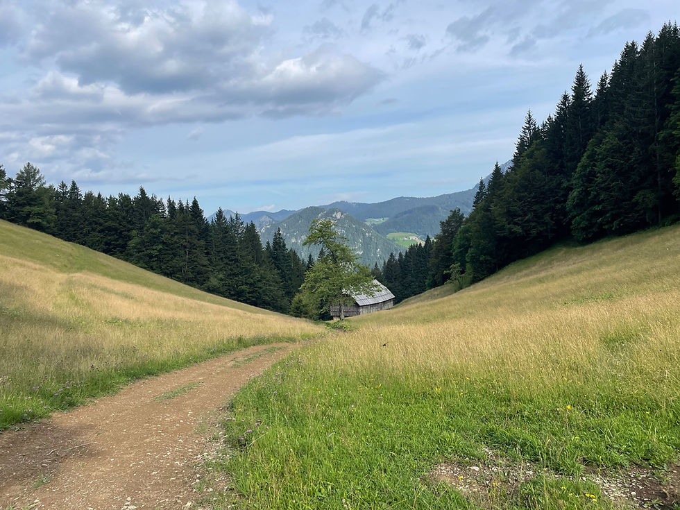
I walk up the road a ways until I see a little water trough next to a picnic table, so I sit and pump some water and eat a snack. The kind host at the Grohotu hut had made me an epic “lunch-bucket” (always a lunch-bucket), of a huge handful of cherry tomatoes, 6 plums, 2 apples, and 2 sandwiches with smoked meat and cheese. As I am sitting at the table, I see three hikers coming down the road-the two guys I hah met yesterday, and a third.
“Did you find another one?” I call to Miho. He smiles big. “He’s done EVERYTHING!”
The third hiker is Boomerang, a German guy that I actually heard of last year on the PCT, because he did a calendar-year Triple Crown in 2022 (the entire AT,PCT, and CDT in a year.). Last year he did the full Hexatreck in France, which is also massive. We all sit and talk for a while at the picnic table. Miho jokes, “well the service here is terrible, they haven’t even brought us coffee yet.”
“One star on Yelp”, I say.
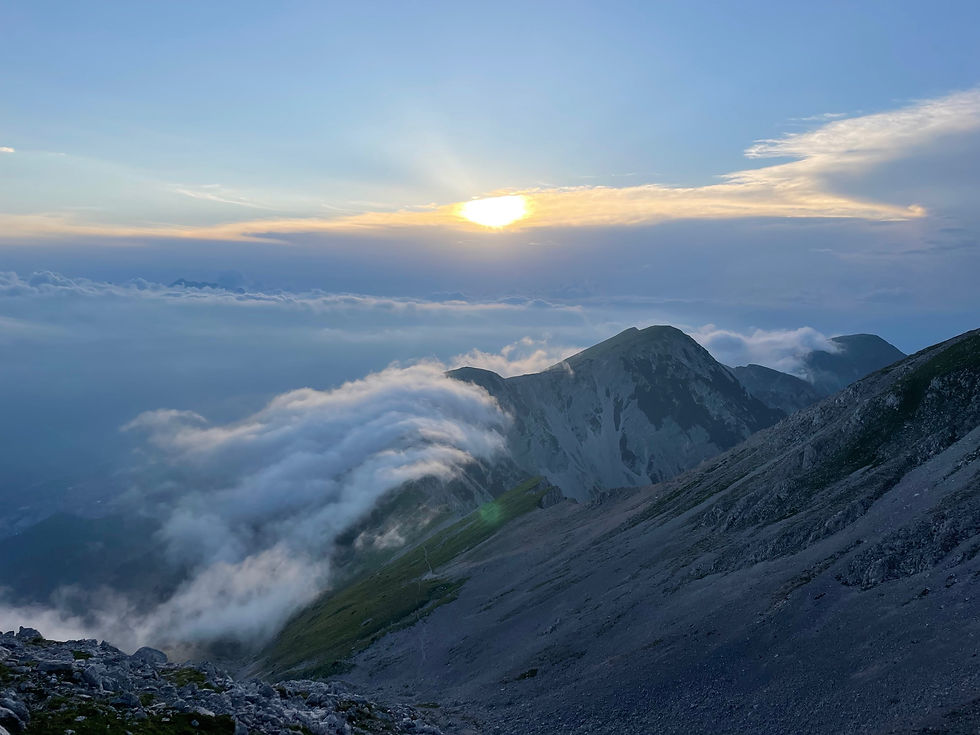
We all start hiking again towards Robanov Cot, a huge park like area in this valley owned by the Roban family for the past 8 generations. The three fast young men take off up the road-I doubt if I will see any of them again, but you never know. I slowly climb up the gentle hill for a few miles, which ends at a huge waterfall at the rock face of the mountains.

Immediately, I encounter my first via Ferrata cables.
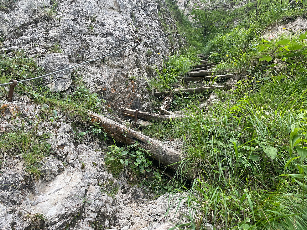
I put on my harness and lanyards and start painstakingly moving my way up the cables. In the second set, an elderly Slovenian man starts coming down the route, unstressed, without any protection all. He patiently waits while I clip, clip, clip my carabiners up the cables and then takes off swiftly after I pass him. It’s a little funny to me.
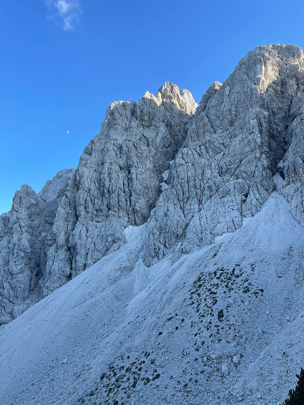
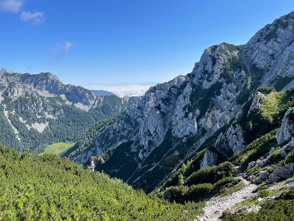
I continue steeply up the route. It’s really, really fun. I don’t really feel like I need full protection on most of it-except for a few truly vertical sections. The Robanov Planina spreads out below me, and after a couple of hours, I can see the restaurant at the base, tiny, like a postage stamp. The scenery is absolutely mind blowing.

The screaming grey walls of Žvižgovec mountain tower above me on my left, and scale around me is just massive. I continue to slowly pick my way up the route-I’m not fast, but I also don’t feel stressed by the exposure.
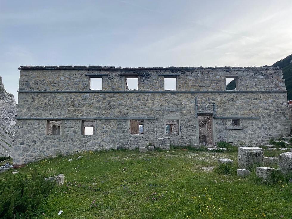
At 4:30 pm I finally crest the lip of the climb, and start walking across the huge open valley towards the Kocbekov Dom. This hut, which used to have almost 100 beds, tragically burned in 2017, and the Slovenian Mountain Association hasn’t had the funds to rebuild it yet.
In the meantime, they have set up a basic cabin with a kitchen, still a full-time host, offering cold drinks, beer, and hot supper.
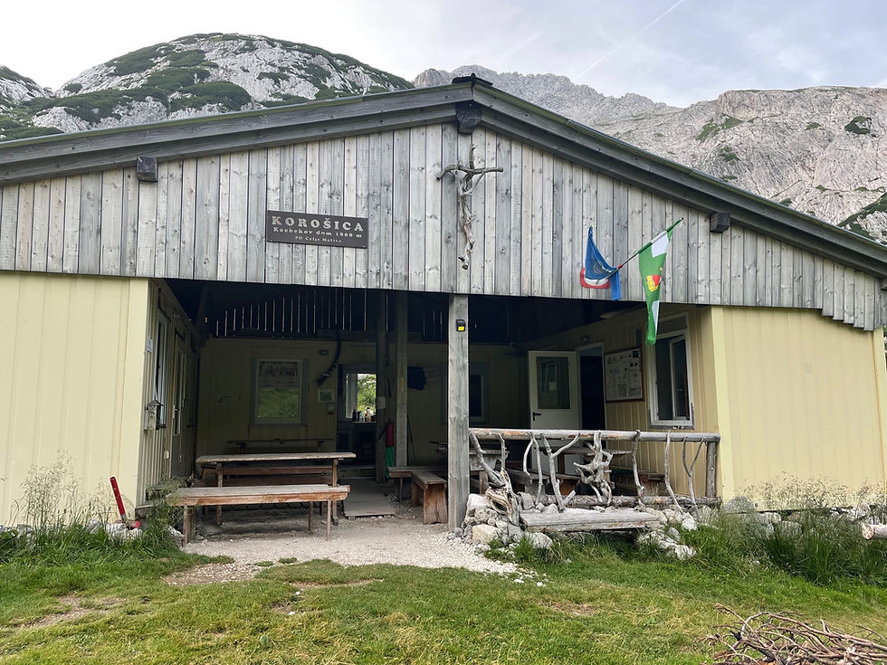
I continue to be amazed by the mountain hut culture in Slovenia. The host greets me and gives me a Radler Isotonic, which I’m drinking a minimum of one per day now. I settle in for the evening. He brings me a steaming bowl of buckwheat soup with sausage, and excitedly tells me, “Trump got shot at! They grazed his ear! Some 22 year old kid!” I don’t have enough internet to fact-check this, oh well.

The valley is beautiful in the evening light, with the sad wrecked mountain hut, which has a sign indicating it was built in 1912. I settle into my bunk for the night. I hiked 12 miles today, with 4300 feet gained.
I get moving around 7:45 today, a little later than I had wanted-it was hard to wake up at 5:30, and I stayed in my little bunk till 6:00. I start to climb steeply up the ridge towards Ojstrica. The trail is well-built, just steep.

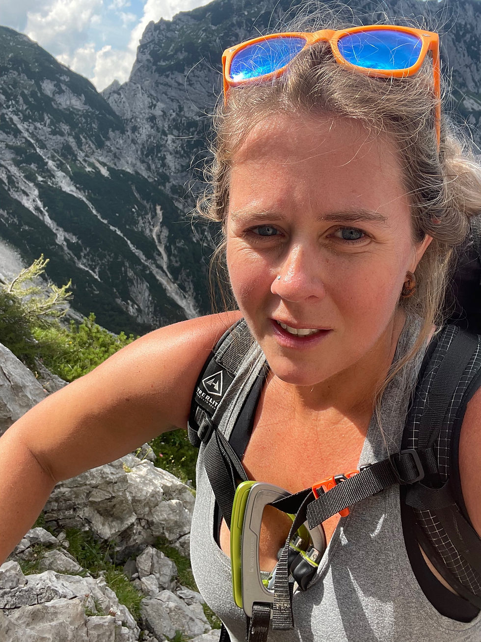
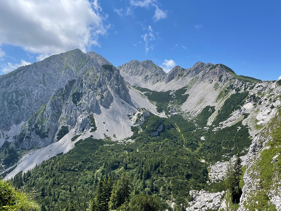
As I approach the ridge, the land becomes truly Alpine-I am following rough trail, traversing just below the ridge, looking at massive structures in front of me, squinting to see where the trail could possibly go.
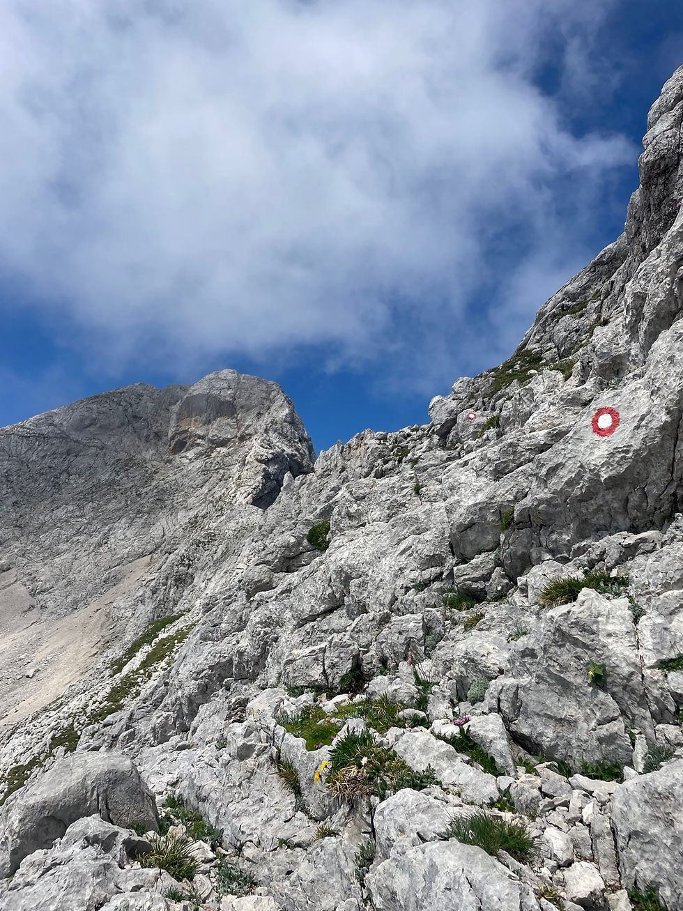
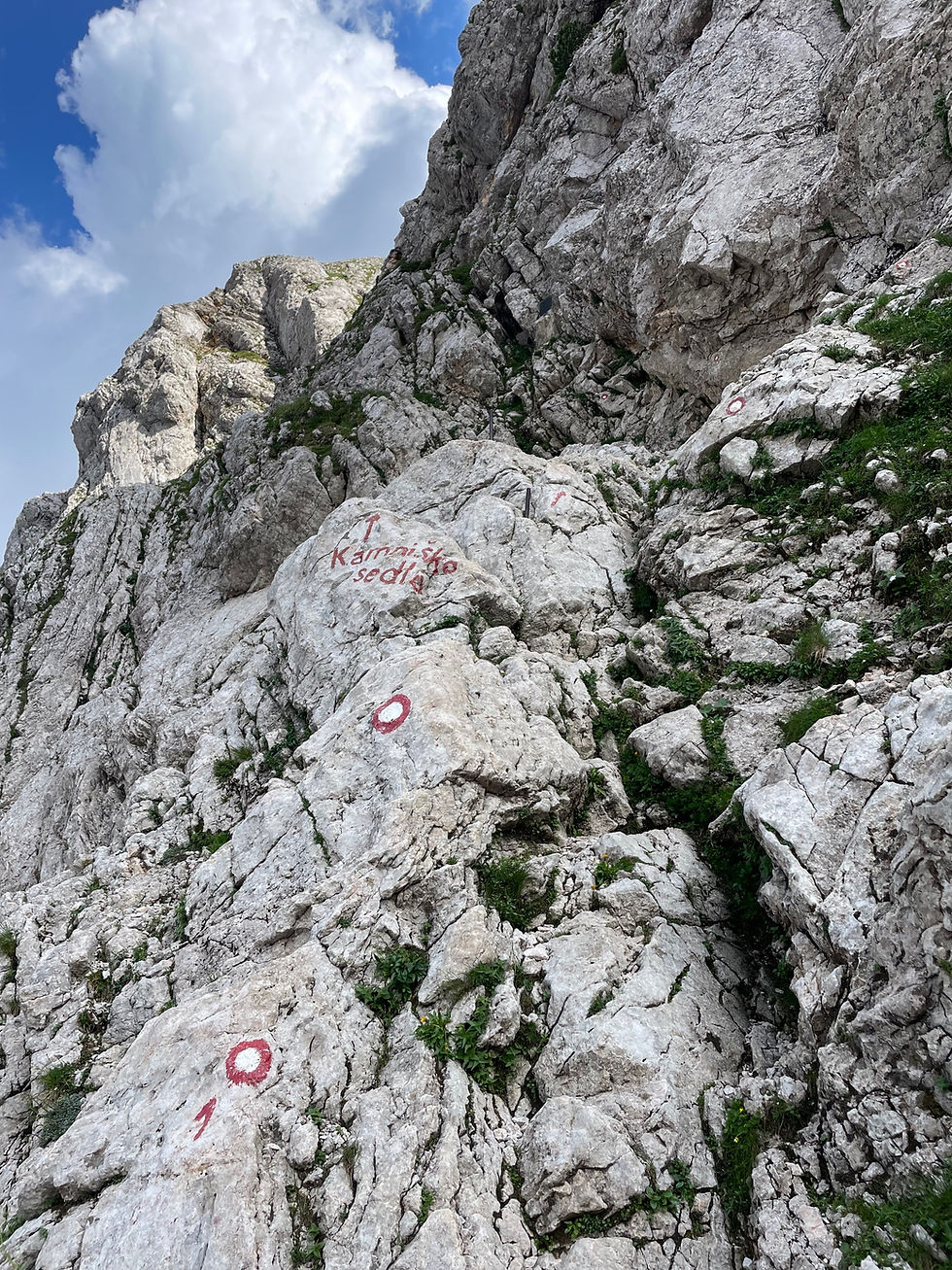
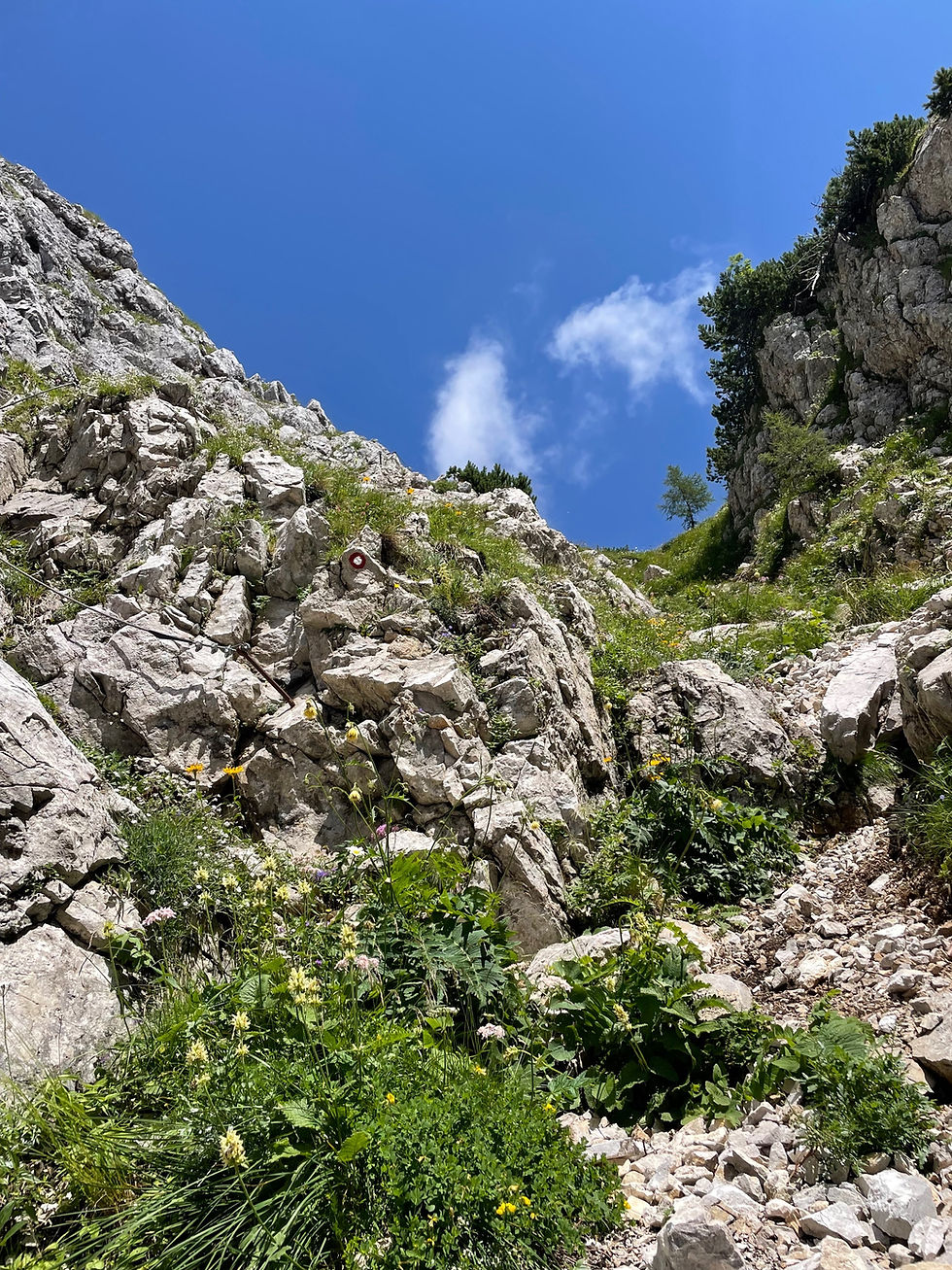
And yet, the red-and-white bullseyes continue on, sometimes steeply up with a couple of steel pegs for assistance, sometimes crossing a loose gully, washed away for a minute.
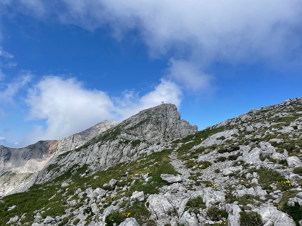
It is sunny and totally clear. I can see in every direction for a hundred miles.

And I feel as if I am on top of the world, clumsily grabbing a rock here, a peg there, seeing things that God mostly intended for the little black birds that play and soar, the lazy ibex lounging in the sun on the rocks.

It is moments like these that I feel the most confused when people say they have “conquered” some mountain-we are so obviously too soft and delicate to really exist up here, for long-with our silly backpacks, Goretex and rubber shoes. We only “conquer” for as long as the mountains decide to accept us-without shrieking wind, driving ice, crumbling stone beneath our feet. We are not in charge.
I pick my way up Lučka Baba, and as I am descending, I hear two voices, and see two young men, trail runners, lightly jog up to the slightly lower peak to my left and then descend, as if it is nothing.
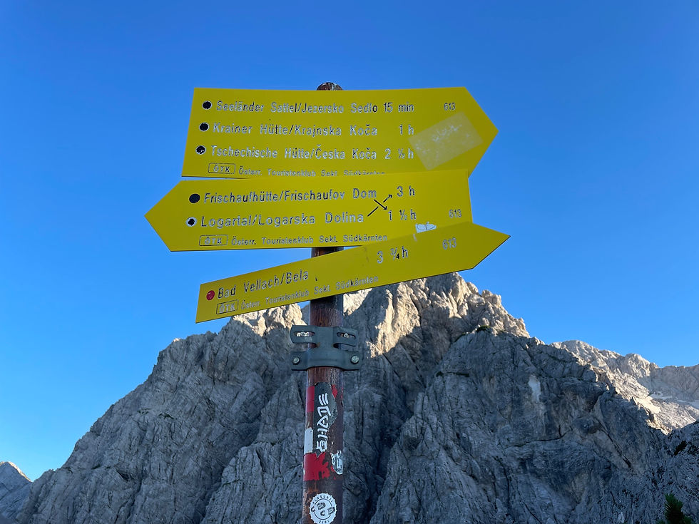
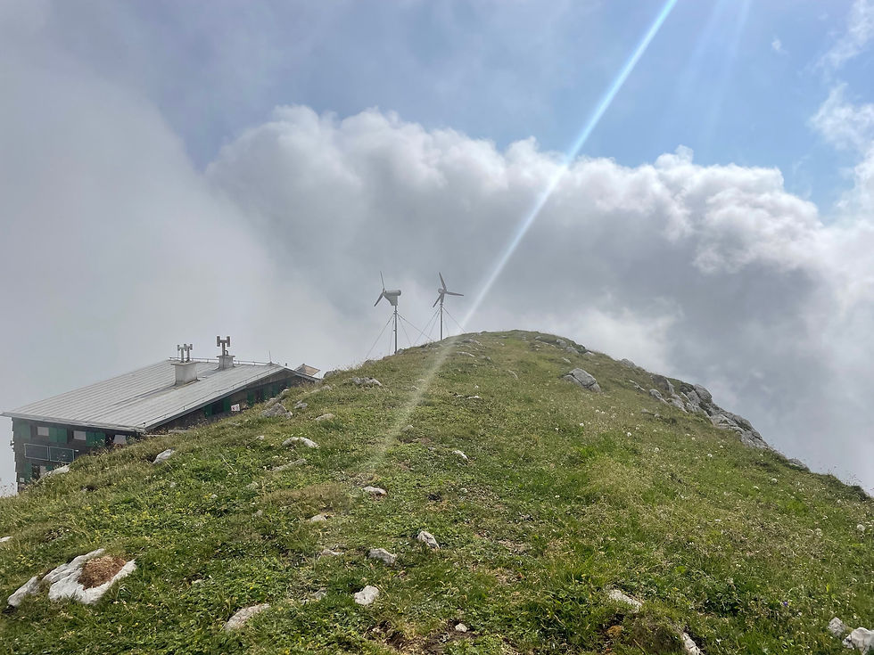
I chat with them for a moment. It’s amazing how young and strong these trail runners can be-really it’s kind of a delight to behold. I continue on my way to the next mountain hut, Kamniška Koça na Kamniškem Sedlu, which is a true Alps high mountain full service hut.

It is busy, with hikers coming and going, relaxing on the front porch, hiking in and out. The host flatly greets me.
“Uh…can I have….two big sandwiches?” I ask.
“Yes. With cheese? Salame? Pickles? Mayonnaise?” He asks.
“Yes. That all sounds amazing.”
I try to control my excitement. I buy the sandwiches, a huge cookie bar, two snickers bar, and a Lasko beer. I continue on down the trail, which descends slowly 2500 feet to the next hut, which is closed. It takes me 2.5 hours to descend just a few miles on the steep trail.
At the closed hut, Frischsaufov, they have a little simple bar set up to serve drinks and snacks. I am tired and would gladly stay here, but the host says, “sorry, the closest open hut is Kamniška.” I fill my water bottles and wearily swing my backpack back on. It is 5 pm.
“Where are you staying tonight?” The host asks me, doubtfully.
I gesture vaguely. “I’m heading towards the bivouac site, near Skuta.” It’s technically illegal to wild-camp in all of Slovenia, and I don’t yet really understand the norms around this-whether it’s looked down upon or if people turn a blind eye if you are considerate and respectful, the way they do in France, Spain, and Italy.
“Be careful. That is a very long way,” he says.
“Thanks, I’ll be okay,” I reply.
I slowly begin to climb again. The air cools, and I hear some far-off waterfall, pouring off the glaciers above me. Two little black-horned deer-chamois in French, camoche in Italian, I don’t know the Slovenian or English names-trot along the scree high above me. I cross a long patch of snowfield or glacier, then another.
Looking at the map, I see an option to cut off some of the current SMT by going directly over the mountains-but the line faintly cuts up a steep scree field, and then disappears into a vertical gully absolutely choked with snow and ice.
That’s a no for me.
I finally pull myself up, once again, onto the ridge-and there is a sign in Slovenian that says “attention! National border.”
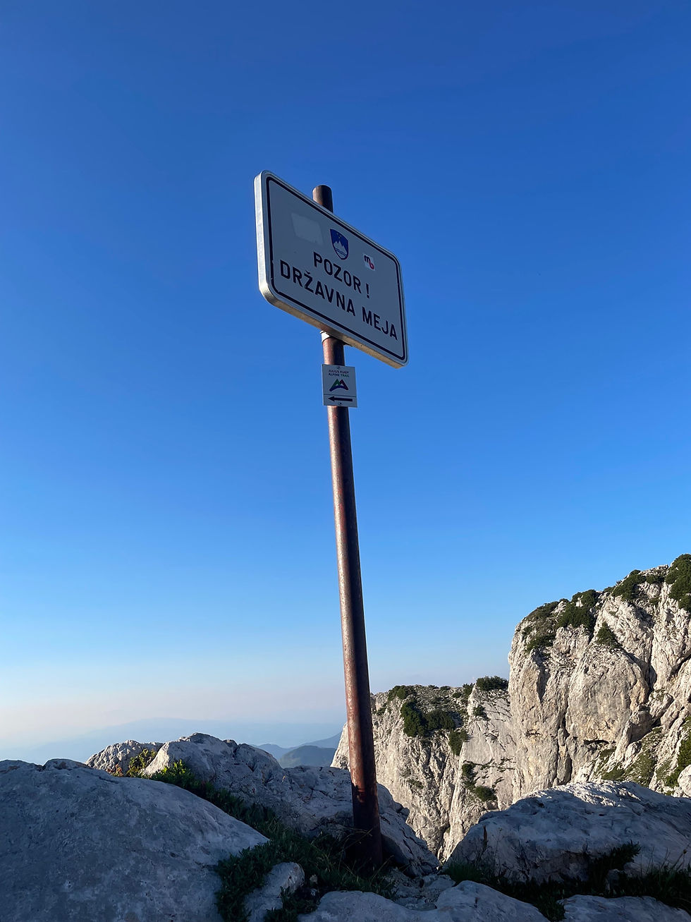
I see old bits of concrete and steel laying around-and directly in front of me there is a perfectly flat, grass-covered, protected patch. I believe that the old border patrol station was here, dismantled when the EU open border policy began.
Scrambling up, I see that the trail signs are in German-i am in Austria, for a moment.

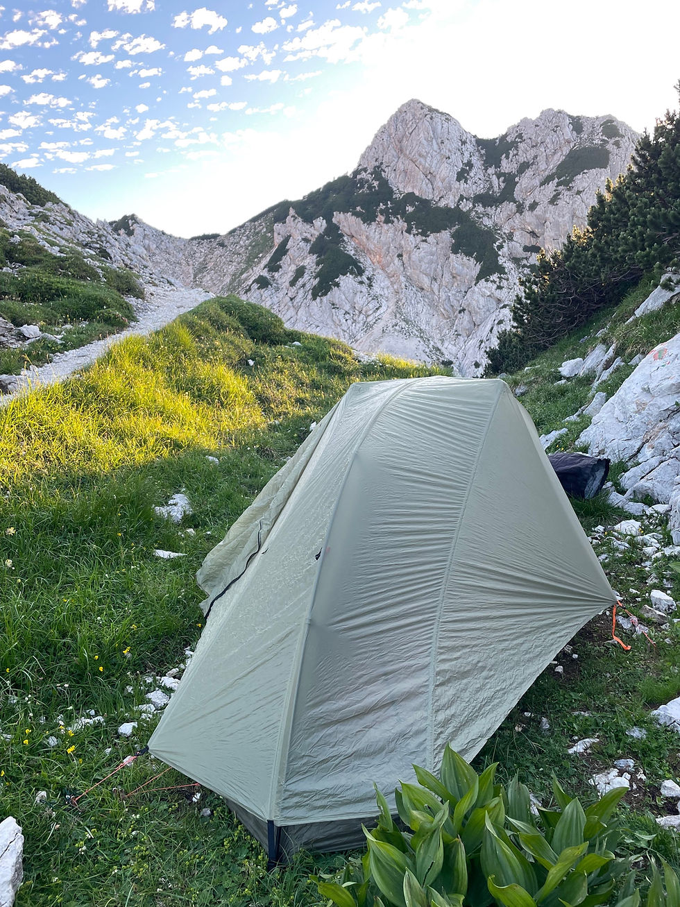
I happily set up my tent on this spot. I hiked 9.1 miles today. I gained 6000 feet.
I wake up with the sun at my little border patrol campsite, pack up, and head along the ridge. The trail hugs the ridge tightly, and the SMT turns sharply to the left to head towards Koroška Rinka mountain, which the guidebook describes as “ very difficult.” Looking at the trail, I see that it passes over a long, steep snowfield or glacier.

Dimly I see a thin white line where the bootpack runs across the steep snow. The runout is hundreds of feet down the mountain. I did not bring an ice axe or traction on this trip. Thinking of my relatively slow pace, and the weather predicted to move in this afternoon, I make the decision to drop down to the next village and cut the rest of this high section off. I feel mildly disappointed to skip a couple of the big peaks in this range, but not disappointed enough to feel exhausted and stressed by being in over my head in these big mountains.

I take a right at this junction and begin the descent to Ledine hut, which is closed. One problem I have here, is that I don’t have good information about how to get out of the high mountains here. The Gaia maps are wonderfully accurate in many ways, but they give absolutely no indication of how difficult a “trail” is. A dotted-line could be a normal walking trail, or it could be an extremely steep boot track, or it could be full Via Ferrata-not too many places to put your feet, a thousand feet of airy exposure, and some steel cables or pegs to help you along. Looking below me down at Ledine Hut, I can see three separate faint dusty lines tracking up off the hut along the side of the mountain. Which one “goes?”
To my relief, I encounter a Slovenian couple in their 50s, coming up the way I am going down. “Dober dan!” I hail them. “Did you guys just come from Zjorne Jezerko?” They both give me the universal quizzical pause as I switch from their native language to American English.
“Yes,” the woman says.
“It is easy? OK to walk? No climb?” I mime rock climbing.
“No, no, easy,” she says. “Uh, is walking….you take Lauska Pot….you remember….other way is very hard, rock climbing. Just take Lauska Pot.”
“OK. Lauska Pot. Hvala!”
They cheerfully wave me on. Well, that’s infinitely more information than I had 5 minutes ago.
I continue picking my way down the steep, chossy trail, that old friend Constanza calls “kitty litter”-little pebbles make it more likely that you will “banana-peel”- your feet sliding right out from under you, landing hard on your butt, or worse. My knees ache. My old injury in my right knee is talking to me, that a PT 15 years ago called “chondromalacia”, after the Appalachian Trail. In some ways, each of my long trails gave me a “gift” to remember them by-an old memory that my body holds, that speaks of trips gone by-the knee that clicks, the Achilles that aches to this day, the panic body-response to cold that was hypothermia in a freak snowstorm in July on a Montana ridgeline, the death-thoughts when water goes over my head from falling into the Popo Agie in Wyoming. Each of these I carry gently, as old roommates. I don’t try and force them out. I don’t, honestly, think they’d go. They are a part of my mindbody that I have built in these fifteen years of being in the high mountains. They are me.

In ten minutes, I hear more voices and see another couple picking their way up the rough trail. As they get closer, I hear that they are speaking English, with an Australian accent. I had heard that there was an Australian couple on the trail, and when they are close, I call, “yay! It’s the Australians!”
“Oh! We heard about you, too!” The man calls back excitedly. They had descended all of the way down this trail, past Ledine Hut, to Česka Koča, the next hut, which has a steep via ferrata connecting it to Ledine hut. They aren’t carrying a tent, and with the two hut closures, this was their only option.
“It’ll be obvious which trail to take, if you’re trying to go all the way down to the valley,” the woman tells me. “Just grab the trail right before Ledine hut. There was an entire camera crew coming up that trail earlier, I guess to film one of the glaciers up here. Like one of the men was carrying this massive tote of equipment on his shoulder.” She considers for a moment. “But, he was Slovenian, so you never know…”
We say goodbye and I continue on down the trail. I eventually come to a parking lot, and I walk down the road in the glittering sunshine, now in the baking midday heat, around a big manmade lake. There is a restaurant here on the lake, and it is teaming with Slovenians, happily drinking beer and eating lunch under big sunshades at long tables, enjoying the summer weather in the countryside. I feel myself relax. This also is a way to be, to enjoy Europe in the summer.
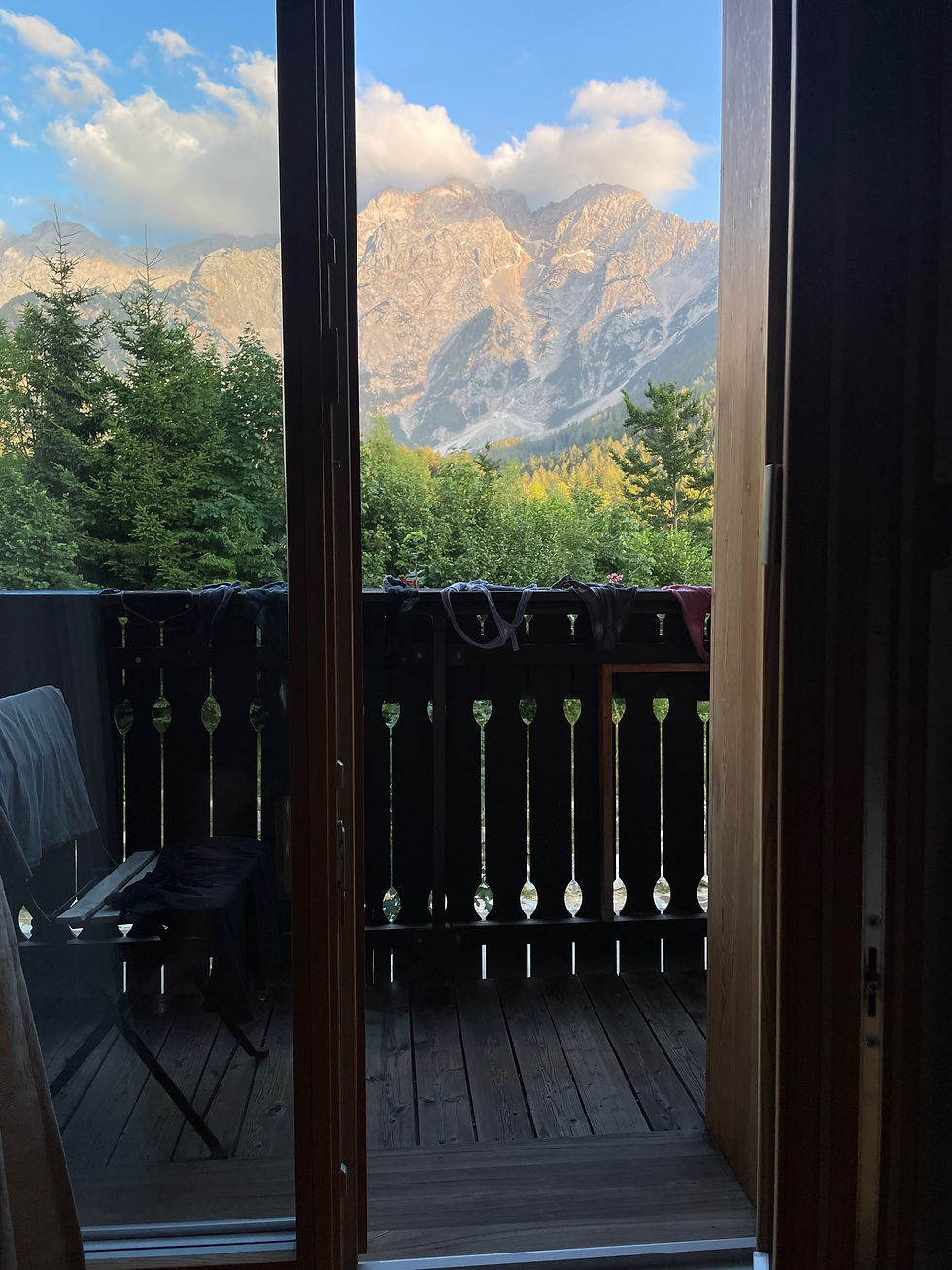
I continue my walk towards the village, craning my neck looking up at the towering peaks above me, where I slept last night. It is absolutely incredible that I was just up there, and now I’m down here, just with the power of my little average-abilitied body. I walk to Vila Koman, a very old house-turned-hotel right on Main Street, run by a young family. My room has a big fluffy bed and a little balcony and big French doors that open up to look at the mountains that I just came from. It cost 90 euros a night. I wash all of my clothes in the sink, and rest.
I hiked 8.8 miles today, the 9th day on trail.
I rested today in Zgornje Jezersko, the 10th day on trail.

I start hiking around 9 am today. The guidebook described today as a “transitional section”, following a road for some miles out of the village and then cutting steeply up into the forest on dirt roads, then steep trail. I finally pop out on a saddle below Storžic mountain and walk laterally to the dom na Kalisču mountain hut. It is only mid-afternoon, but I don’t really want to climb Storžic right now.

There is no one else in the hut, and the host is a woman in her 70s that speaks no English. She makes me a delicious dinner and I eat all of it. The food in the huts is really a surprisingly huge bonus on this trail. I lay down early, listening to the evening bugs and the fountain outside. I hiked 8.4 miles today, my 11th day on trail. I gained about 3000 feet.
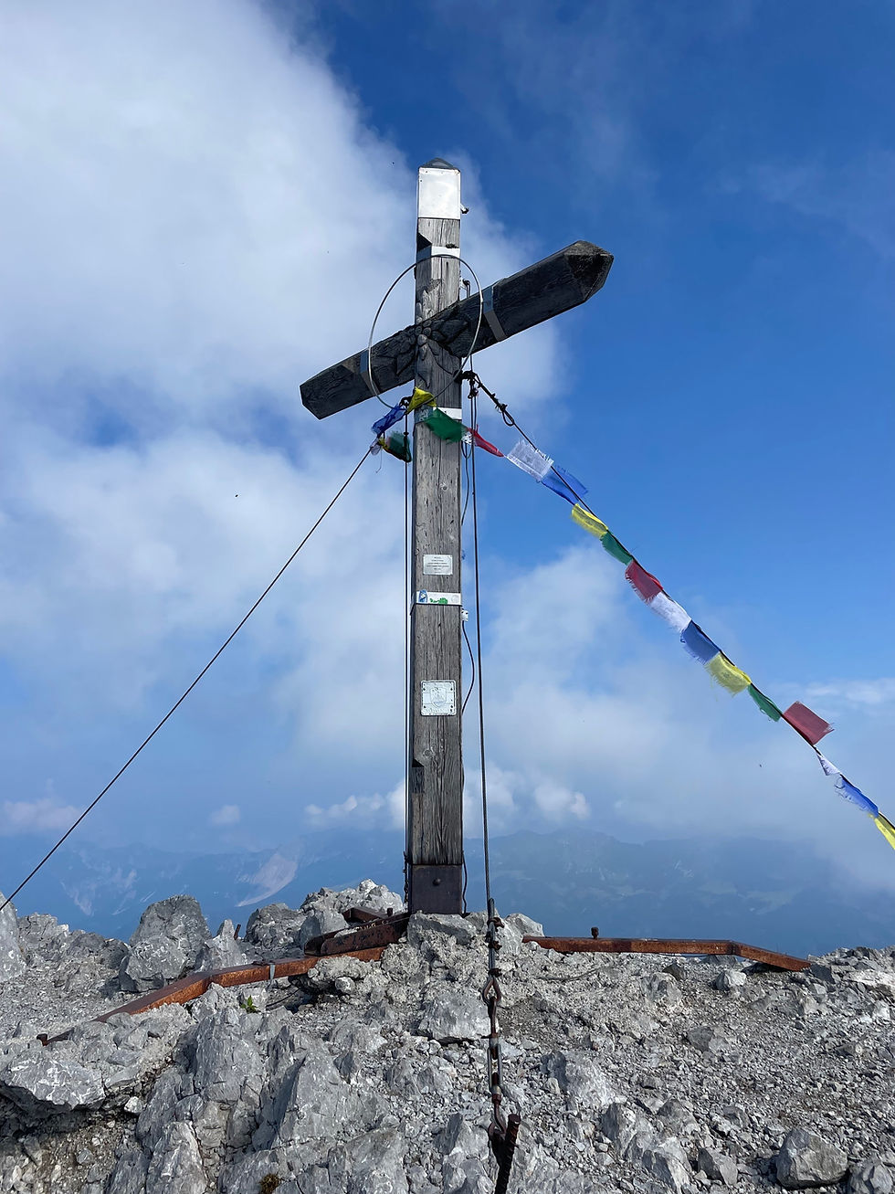
I start hiking at 6:30 am. I immediately begin the climb straight up Storžic peak, which is steep hand-over-foot climbing. Storžic is the last peak in the Kamnik-Savinja Alps range. It is clear and beautiful as I top out on the summit.
Picking my way down takes a long time-the trail is rough, with steep cables and pegs intermittently available to help.
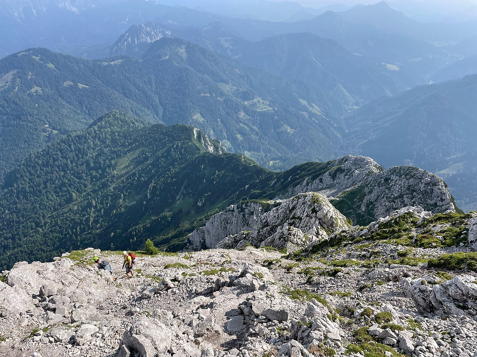
The views, at least, are stunningly beautiful.
The weather changes as I descend, and I hear a big crack of thunder-looking back at the peak, I see a big thunderhead making its way my direction. Time to get off this ridge. I drop down onto a side trail, and sitting down to eat a snack, I hear some tinkling bells-a little pack of goats makes its way down the steep mountain trail, towards me. They all look at me, surprised. I continue on down the trail, and they follow behind-every time they round a corner and see me, they give me the same suprised expression. This strikes me as incredibly funny for some reason. I see no farmer or dog-these goats just seem to be on their own little mission.
I finally drop down to the town of Tržič-elevation 1700 feet. Everything aches, and my knees are tender. I slowly make my way into a big supermarket, placing my backpack in a shopping cart and pushing it, just like the PCT hikers do in the Vons in Bishop. I feel my dirtiness, and my strangeness-I buy a few snacks for the last few days before the next town-dried apples and dates, and cheese, and cookies. I wearily make my way to the little apartment that I had booked - it is amazingly silent and clean. I open the big windows in the bedroom, and I am laying down to sleep, a storm starts-lightning cracks in the dark and rain pours, outside. I hiked 13 miles today and gained 4000 feet, my 12th day on trail.
I wake up, sluggish and with back aching in my little apartment in Tržič. I don’t leave to start hiking until 10 am.
It is overcast, and humid, and warm-and I am sweating almost immediately climbing on paved roads out of the town of Tržič. The town’s elevation is only 1700 feet. And I am immediately climbing back up into another mountain range, the Karawanks. I feel tired, and irritable, and just generally
glum like the weather.
Misty rain falls on and off as I climb, climb, climb. The temperature gets cooler as I gain elevation, and I am mostly walking in the forest now-beech forest, which I will always associate with Europe.
In the evening, I finally come upon what I thought was going to be a mountain hut for lodging. As I approach, I see lots of parked farm equipment, with chickens pecking around. The wire fence I unlatch to cross is electric. This is not really looking like a mountain hut.
A woman is sweeping outside and I greet her, a little hesitantly- “dober dan….do you take lodgers here; is this a mountain hut?” She shushes a child inside. “No, for staying overnight we don’t have. It’s Roblekov Dom.” She points up the dirt road.
I thank her and wearily let myself out the gate. I made a tactical error here-I really thought I would be able to stay. I see a PZS red sign on the road. It indicates that the Roblekov mountain hut is 1 hour, 45 minutes away. I look at my phone-it is 6:15 pm. That will be too late to be served dinner, and that’s assuming I actually walk the pace that the sign indicates.
I continue up the dirt road, which turns off soon into a trail. I immediately notice lots of flat places, under huge pine trees-cattle have been here. I listen carefully. It’s quiet, but after a little bit I do hear the faint tinkle of bells, and goats bleating. They’re probably on the open field that the map indicates is ahead on this trail. I’m not afraid of goats, but I’d rather not have an awkward run-in with a confused shepherd, herding his animals by my tent tonight or in the morning. But, I sit and eat a snack, and all is quiet-so eventually around 8 pm I set up my tent under a big tree on a relatively flat place.
I hiked 11.8 miles today. I gained 5000 feet, on my 13th day on trail.
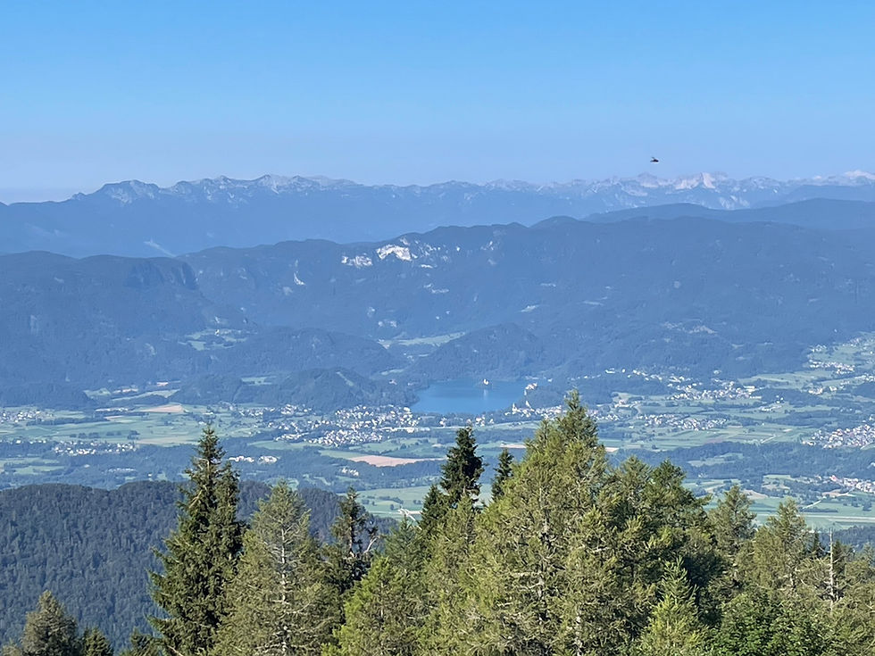
I get going this morning just after 7 am, when it is still cool, and I still need my puffy down coat. I continue up and around Bejunjščica mountain, traversing under the peak, to Roblekov hut. The mountain hut is pleasant in the morning sunshine, with lots of weekenders coming and going, and I order a coffee and sit on the terrace. Looking down below into the valley, I see a large blue lake with what looks like an island and a castle in the middle. “Is that Lake Bled?” I think to myself. I check the map-it is in fact Lake Bled. I hadn’t realized how close I was to this famous lake.
I continue on the trail, which is a little bit scrambly with little secured sections of via ferrata. None of it is too difficult, just what I would call “picky”-not too fast, and you might have to look carefully where to place your feet.
I come to one drop off that is maybe 12 feet and with steep, moist rock and a cable. A man and two women are standing below. I call to them, “you can come up if you like, I’ll wait.”
“No, you can come down,” the man responds. I take a look at the line and petulantly test a couple of footholds, then decide to take my backpack off. The man says, “here, I’ll help you.” He comes up and takes my backpack for me, then stands next to me as I lower myself down, giving unsolicited advice-“put your hand HERE. Put your foot HERE.” As I reach the bottom, he says, “next time don’t do this alone.”
“There isn’t anyone else to bring with me. I’m from America and I’m doing the Slovenska Planinska Pot (Slovenian Mountain Trail),” I respond.
He doesn’t have any more commentary for me after that. I thank him for his help with my backpack and continue on my way. I arrive at the Zelenici hut a couple hours later, and have lunch there before continuing on-beef soup with noodles. Then, I start the long beautiful ascent towards Stol peak.
The trail is easy, and I am happily listening to Dune on Audible, when I round a corner and am faced with a steep, loose gully. There are some via ferrata cables mounted on the rocks on one side- I start climbing down these, then the rock wall becomes almost shear, with narrow crumbling footholds, and about a 25-foot drop into the loose gully. Nope.
I carefully back off, climbing back to the start of the cables, and pick my way slowly down the steep gully instead. Well, that came out of nowhere.
I continue onwards and upwards. The trees eventually give way to all rock, and I am back in the alpine.

A group of hikers wearing via ferrata gear and helmets comes down the trail from the peak-and I am surprised to hear them speaking German. “Do you know where the next hut is, below?” A man asks me.
“Whoa, you guys are talking German- did I accidentally cross into Austria?” I ask.
“No, this is Slovenia,” he laughs. I show him my map on my phone and the group cheerfully continues on.
The weather is changing- big, silky-white clouds are moving in and out, and I am engulfed in them as I top out, sweating, on the big summit plateau of Stol.

I somewhat blindly make my way towards where the map says the hut is, on a hill just to the left of the summit. I hear the tinkling of bells and see a herd of sheep, spread out on the summit and bleating to each other.
A cloud settles around me, and the late afternoon sun blazes through-and everything is dazzlingly white, and I look at the green grass beneath my feet, and the feeling of sweat on my back and the aliveness of my big leg muscles, and the way I am seeming to stand on the top of the world-and I think, “this feels like I have died and am in heaven.” And for a moment I try and encapsulate this memory-the way the wind feels, and the bleating lambs, and the tinkle of bells, and the glittering white abyss-to remember, later, when my legs will no longer take me, by myself, to places like this, when I am an old woman.
I drop down to the hut. A young Slovenian man in his early 20s with clear blue eyes is sitting outside, calmly smoking a cigarette. I ask about staying the night, and he directs me inside. It is warm inside and smells of woodsmoke, and home cooked food. I settle into the bunkhouse and then enjoy my second soup of the day-cabbage soup with ham. I sleep deeply through the night, the wind gently rocking the hut at the top of the world. I hiked 9.2 miles today. I gained 5200 feet. This was my 14th day on trail.
The weather turns in the night. I wake up to a cold wind, and overcast. I make the decision to drop off the ridge, down to Lake Bled. I take a steep trail down out of the Alpine, then a long series of dirt roads until I am in the valley.
It is hot, and then hot and sunny down here.
Looking back, I am amazed that I can still see the mountain hut on top of Stol, some 5500 feet above me. I walk in the blistering sun through the valley to lake Bled. This is a tourist hot spot-and all around me I hear American English. I don’t mind at all-it’s nice to be in a place with city comforts for a little while, and to not feel so much like I have to struggle to understand and be understood. I check into a little simple hotel, Union Penzion-which appears to be a converted office space, but is simple, quiet, clean, and cheap. The owner, Lado, asks me what my plans are tomorrow.
“Well, I’m going to get myself to Mojstrana and the beginning of Triglav National Park,” I respond.
“And you’re walking there? That’s 25 kilometers,” he says, doubtfully.
I shrug. “Maybe. Or maybe I can find a bus for part of it.”
“Well, if you just walk four kilometers to Lesce, there’s an easy bus right to Mojstrana,” he shows me on a big map.
“That would definitely be easier,” I agree.
I let myself into my little office-space room and fall into an exhausted heat-induced nap as the sun sets. I walked 13 miles today. I lost 5500 feet of elevation. This was day 15.
I rest in Mojstrana for days 16 and 17.
Kommentare